Cityzenith announced the commercial launch of its much-awaited Smart World Pro 3D data platform, a new high-performance version of the company’s flagship Smart World product for Architects and Property Owners.
The “Digital Twin Data Platform of Choice” for the building industry, Smart World Prorevolutionizes the way Architects and Property Owners use public, project, and property data (spatial and non-spatial) to make better decisions during the planning, design, and operational phases of the building lifecycle, unlike any tool in the market today.
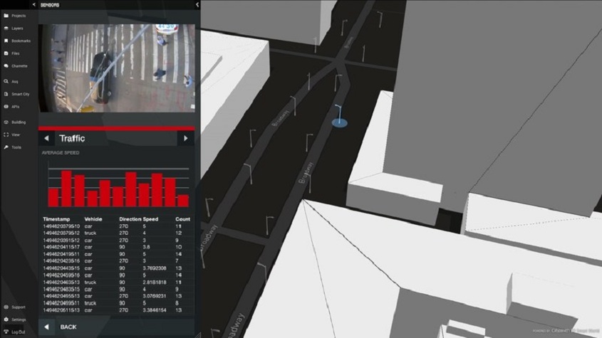
For the first time, users can aggregate BIM, CAD, CRE, and GIS tools, spreadsheets, documents, IoT and BMS sensor feeds, social media posts, etc., all in one universal 3D data platform that anyone can easily use. Just “drag and drop” your BIM and GIS files right into Smart World to get started on your journey into a new world of data and advanced analytics. You will never do a project the same way again.
Users can also ASQ questions of their data like never before, and execute complex queries using “everyday language” that search through thousands of curated city and project data layers in seconds to find and visually display results.
What’s more, with the release of Smart World Pro, the company has introduced Mapalyze, a new app suite of analytics tools that allow users to run project analysis on the fly, and export and share results in seconds. New apps in this release include View Corridor and Zoning Analysis, Traffic and Microclimate Simulation (via third parties), and more.
Cityzenith is now collaborating with leading universities to expand the suite of apps in the Mapalyze store, integrating computational tools developed by the world’s greatest minds that will soon offer customers a full range of analytics options.
Smart World Pro is built on the Unity game engine, offering navigation speeds 10x faster than the previous version, and provides users access to thousands of 3D city models from OpenStreetMap in over 200 countries, and 10’s of 1000’s of curated public data layers. We also transitioned to Mapbox for our map and satellite imagery to ensure our data is always accurate and up to date. For advanced users, a new command line tool allows you to batch upload models, invite multiple users, and even tap into APIs.
About Cityzenith
Cityzenith’s award-winning Smart World Pro™ software platform revolutionizes the way building professionals aggregate and analyze their Big Data to better design, build, and operate complex, multi-building project locations of any scale, anywhere in the world. Developed by the creators of Google Earth, Smart World Pro’s unique 3D game-like user interface and simple drag & drop functionality make it easy for users to consolidate all their project data for both existing and new building assets in a single digital platform, bridging the data gap from design to operations unlike any other tool in the market today.


