Professional surveying teams are involved in a huge range of civil construction projects, including the planning and delivery of new roadways. Roadworks surveying is a broad discipline that includes dozens of surveying techniques. Each of these provides information that project planners can use to deliver their projects on time and on budget. In this article we’ll go over some of the most common types of roadworks surveys and how they support civil construction projects.
1. Land Surveys
Land surveys are a critical part of constructing new roadways. Before any work can begin, a surveying company will assess the available area and look for the best place to build a new road. When determining where to position a new road, surveyors consider things like:
- Local terrain features like hills, valleys and vegetation
- Overland and subterranean waterflow
- The location of infrastructure such as sewers, stormwater pipes and overhead power lines
- Surrounding homes and other structures
- How the road will be used
- Grading and slopes along the potential route
- Soil stability
- Bridges or tunnels that need to be accessed
Selecting the best place for a new road is a careful balancing act. Project managers need to weigh up the costs of the project versus the construction costs. For example, it might be simple to build a road in a straight line, but the costs could be exorbitant if that requires the construction of tunnels or bridges.
2. Terrain Mapping
Terrain maps and 3D models are used throughout the design and construction process to assess the optimal placement of new roads. Understanding the lay of the land allows for more efficient construction methods and can help construction crews alter their plans if necessary.
These days terrain mapping is provided by drone surveying companies. Drones can be equipped with a variety of cameras, GPS locators and LiDAR sensors. This allows them to capture detailed location information that can be translated into 3D models. In many cases these 3D models are then used to accurately model earthworks and construction requirements, making it simple to develop cost projections and a Bill of Quantities.
3. Volumetric Surveying
Volumetric surveying is used to measure the volume of 3D shapes. In the case of roadworks, volumetric surveys are used to calculate the amount of earthworks required during construction.
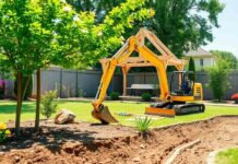
Earthworks are a major part of any road project. This is because roads are more than the tarmac surface you drive on. Instead, roads are made up of multiple layers of stable footing materials. These layers greatly improve the longevity and durability of the road, but they take up significant volume and are prone to washing away. To prevent this, construction crews excavate the entire length of the roadway, which can amount to millions of tonnes of earth. Volumetric surveys provide accurate estimates for earthworks requirements, allowing construction teams to effectively plan their materials and equipment needs.
4. Engineering and Construction Surveys
Roads are complicated constructions. While they might look flat, roadways use complex geometry to improve safety, provide drainage and help drivers maintain control of their vehicles. New road projects are always accompanied by comprehensive engineering requirements that provide details on the shape, slope and curve of each section of road.
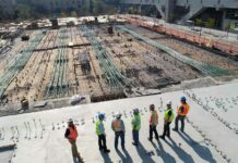
Meeting these requirements can be a challenge. Engineering surveys support construction teams by assessing the work that has already been completed and comparing it to the original plans. This makes it simple to adjust course and ensure the final product meets safety requirements.
5. Grade and Camber Surveys
Modern drones can be used to create 3D models of roads that are under construction. These 3D models allow decision makers to view cross sections of each road piece to assess the slope (also called the grade) and camber. These two factors are critical for road performance, but they can be difficult to assess while on the ground. Because construction crews work on small stretches of roads, new projects are prone to uneven surfaces that create uncomfortable or dangerous driving conditions. Grade and camber surveys allow construction crews to keep their work on track and improve the quality of finished roads.
6. Materials Stockpile Surveys
The sheer volume of materials involved with constructing a new road is a serious hurdle. Each section of road requires hundreds of tonnes of earth, sand, gravel and tarmac. Transporting and storing these materials is a point of major inefficiency. Roadworks surveying can be used to assess materials requirements at every point along the route and ensure stockpiles are available in the optimal location. This reduces the amount of handling onsite and can allow excavated material to be reused as infill more effectively.


