

























Construction teams used to plan around a survey that took a long time to produce and quickly went stale the moment ground conditions shifted. While this approach was appropriate when timelines were forgiving and budgets had room for surprises discovered midproject, jobsites today have evolved considerably.
A new set of mapping technologies, built around laser scanning and software that keeps updating as a project evolves, is changing when critical decisions are made and how much guesswork is left in them. Instead of discovering a grading problem after equipment is already on-site, teams are increasingly catching it during the planning phase.
Why Are Traditional Surveys Beginning to Fall Behind?
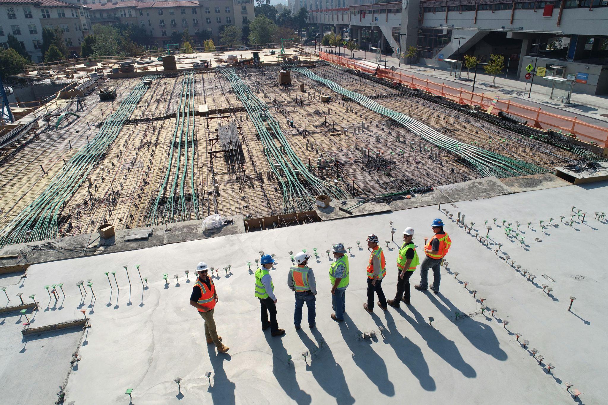
Conventional land surveys typically rely on a small crew walking a site with GPS equipment or a total station, capturing points one at a time. The method is accurate for what it measures, but it measures selectively. A surveyor chooses the points that matter, which means anything outside that selection isn’t in the data.
If a site has complex terrain, this level of selectivity can become a risk. Digital mapping tools flip the approach by capturing everything in a given area at once, then letting engineers decide what matters afterward, as opposed to guessing beforehand what to record.
Lidar Scanning and the Case for Millimeter-Level Ground Truth
Light detection and ranging (lidar) works by firing pulses at a surface and measuring how long the light takes to bounce back. This effectively builds a dense point cloud that represents the physical world with remarkable precision.
Researchers studying utility tunnel construction have used lidar captured from handheld devices to track excavation progress over time. They apply image analysis to the resulting point clouds so crews can monitor pipe installation without stopping regular work to take manual measurements. With this technology, a single survey turns into an ongoing record. A project manager can compare current conditions against the design intent at almost any point in the schedule rather than waiting for a planned inspection.
Photogrammetry as a Lower-Cost Way to Capture Large Areas
Photogrammetry has become a practical alternative for teams that need to cover large open areas without the equipment costs often associated with laser scanning. The method builds a 3D model by stitching together overlapping photographs, usually captured from a drone flying a grid pattern over the site.
It tends to trade some precision for a lower cost of entry, which makes it attractive for earthwork-heavy projects where broad coverage matters more than capturing every fine detail. The ideal choice often comes down to the specific job at hand. Photogrammetry can struggle to match lidar’s accuracy in areas with dense vegetation, while performing comparably well and far more cheaply on bare, open ground.
More accurate estimates also mean less over-excavated soil getting trucked off-site, cutting down on excess fuel-burning. This is especially valuable when taking into account the considerable negative impact traditional construction has on the environment.
Drone-Based Data Collection and Faster Site Turnaround
Regardless of whether a crew is capturing lidar or photogrammetry data, drones have become the delivery mechanism for both. A single flight can cover ground that would take a walking survey crew days to complete. However, that speed comes with a regulatory layer.
Commercial drone flights on a construction site fall under federal rules that govern everything from pilot certification to altitude limits, and current guidance confirms that operators need to register each aircraft and pass a knowledge test before flying commercially. Once that groundwork is in place, though, the operational upside is significant. Teams can rescan a site following a storm, after a change order or simply on a weekly cadence, building a data history that a single traditional survey was never designed to provide.
Turning Scans Into Models Teams Can Plan Around

Raw point clouds and photogrammetry meshes are only useful once they are converted into something a design team can act on, which is where building information modeling comes in. Feeding scan data into a BIM environment lets architects and engineers overlay the as-built or as-existing conditions directly against the design. This enables them to flag clashes or discrepancies while they’re still cheap to fix.
A broad review of BIM adoption across infrastructure projects found that this kind of real-time, data-driven approach consistently supports faster decisions during the planning phase, well before those decisions become expensive to reverse on-site. The trade-off is that this workflow demands more coordination between surveyors and project engineers than a traditional handoff ever required. That’s because the value only shows up when the data gets used rather than filed away.
Digital Twins and Moving Decisions Earlier in the Timeline
The most ambitious version of this shift is the digital twin, a continuously updated virtual model that mirrors a physical site as it changes throughout construction. Unlike a static BIM model created once during design, a digital twin ingests new scan data over time, staying current as the actual site diverges from the original plan.
A recent scientometric review of digital twin research in construction found that publication activity has grown sharply in recent years. It rose from 123 publications by September 2022 to an estimated 160 in 2024 as interest in the technology continued to accelerate.
Government researchers studying the underlying technology describe digital twins as tools that let organizations observe, predict and optimize a system in near real time. Construction teams are starting to apply that same logic to identify problems before they turn into costly field changes. The practical effect is that decisions once made reactively, after a problem showed up in the field, are increasingly made proactively, while the model is still just a model.
The Big Shift Is in the Timing
For an industry that has historically made its biggest and most expensive decisions on incomplete information, the value of this shift is really about timing. If a team can see a problem coming earlier, it becomes cheaper to solve, since it still only exists on a screen. Together, these tools are turning site planning into a more continuous, data-driven process that helps companies reduce uncertainty before construction begins.