

























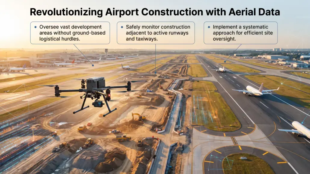


Aerial data collection is rapidly becoming a standard requirement for large scale infrastructure projects, especially within the highly regulated environment of international hubs. The implementation of This systematic approach to site oversight allows project managers to oversee vast areas of active development without the logistical hurdles associated with ground based surveying. In the context of airport construction, where work often occurs adjacent to active runways and taxiways, the ability to capture high resolution imagery from above provides a layer of oversight that was previously unattainable through traditional methods. This technology enables a continuous flow of visual information that keeps stakeholders informed of progress, potential hazards, and resource allocation needs. By integrating these systems into the project lifecycle, developers can ensure that every square meter of the site is accounted for, reducing the likelihood of costly delays or safety breaches. The shift toward digital aerial oversight represents a significant evolution in how aviation facilities are built, prioritizing transparency and precision in every phase of the build.
Automated Aerial Mapping and Volumetric Analysis
The core utility of utilizing aerial platforms lies in the ability to generate highly accurate models and topographic maps in a fraction of the time required by manual teams. Within the airport sector, where massive earthmoving operations are common for runway extensions or new terminal foundations, understanding the exact volume of material moved is essential for budget management. Drone-Based Construction Monitoring Improving Airport Project Visibility facilitates the creation of orthomosaic maps that provide a comprehensive view of the entire site. These maps are not merely pictures; they are data rich files that allow engineers to measure distances, areas, and volumes with centimeter level accuracy. When a contractor claims a certain amount of fill has been deposited, project owners can verify this instantly by comparing the latest aerial scan against the original design grade. This level of verification builds trust between all parties and ensures that payments are made based on actual work performed rather than estimated figures.
Beyond simple measurement, these aerial datasets are integrated into building information modeling (BIM) systems to provide a side by side comparison of planned versus actual progress. By overlaying the drone captured point clouds onto the architectural models, project teams can identify deviations early. If a structural column is misplaced or a drainage trench is being dug along the wrong path, the discrepancy is visible long before it becomes a structural problem. This proactive approach to quality control is particularly vital in airport projects where the complexity of underground utilities and specialized pavement requirements leaves little room for error. The high frequency of these flights, often occurring weekly or even daily, creates a chronological record of the project that serves as a definitive source of truth for all engineering queries.
Enhancing Safety Protocols in Active Aviation Environments
Safety is the primary concern for any project occurring within the perimeter of an operational airport. The presence of ground crews in proximity to aircraft movement areas introduces significant risks that must be managed with extreme caution. Utilizing Drone-Based Construction Monitoring Improving Airport Project Visibility reduces the need for human surveyors to enter these hazardous zones. Instead of sending a team to walk the length of a taxiway undergoing resurfacing, a drone can capture the necessary data from a safe altitude. This minimizes the risk of incursions and ensures that work can be monitored without interrupting flight operations. The ability to conduct these inspections from a remote location also means that fewer personnel are exposed to the environmental hazards of a busy construction site, such as heavy machinery movement and high noise levels.
Aerial monitoring also plays a critical role in identifying safety violations that might be missed from the ground. An overhead view can reveal improper storage of flammable materials, lack of perimeter fencing, or workers operating without appropriate fall protection on elevated structures. Safety officers can review the footage to identify patterns of behavior that may lead to accidents, allowing for targeted training and intervention. Additionally, drones equipped with thermal sensors can detect heat signatures from equipment or electrical systems that may indicate a fire risk or mechanical failure. This early detection capability is a vital component of a comprehensive risk management strategy, providing a layer of protection that complements traditional ground based safety inspections. By maintaining a constant eye on the site, project leaders can foster a culture of safety that prioritizes the well being of every individual involved in the project.
Real Time Progress Tracking and Stakeholder Reporting
Effective communication is often the difference between a project that remains on schedule and one that descends into chaos. Large airport expansions involve a multitude of stakeholders, including government agencies, airline partners, local authorities, and multiple tiers of contractors. Drone-Based Construction Monitoring provides a visual language that everyone can understand. Rather than relying on technical spreadsheets and abstract progress reports, project managers can present high resolution video and 3-D models that clearly illustrate the current status of the work. This transparency is invaluable during board meetings and public consultations, as it allows stakeholders to see exactly where their investment is going.
The speed at which this data can be processed and shared is a major advantage. In the past, waiting for a survey report could take weeks, by which time the information was already outdated. Modern drone workflows allow for data to be uploaded to the cloud and processed within hours. This means that if a critical milestone is reached on Tuesday morning, the entire project team can be reviewing the visual confirmation by Tuesday afternoon. This rapid feedback loop enables faster decision making. If a particular area of the site is lagging behind, resources can be shifted immediately to address the bottleneck. The ability to provide this level of detail to airline partners is also beneficial, as it allows them to plan their future operations with greater confidence, knowing exactly when new gates or runways will be available for use.
Quality Assurance for Specialized Pavement and Infrastructure
Airport infrastructure is subject to extreme stresses, from the weight of wide body aircraft to the heat generated by jet engines. The quality of the pavement and the precision of the installation are non-negotiable. Drone-Based Construction Monitoring assists in the rigorous quality assurance processes required for these specialized surfaces. High resolution cameras can detect surface cracks, drainage issues, or inconsistencies in the concrete pour that might not be visible to a technician standing on the ground. By identifying these issues during the construction phase, repairs can be made while the equipment and materials are still on site, significantly reducing the cost and time required for rectification.
Additionally, drones can be used to inspect hard to reach areas, such as the underside of terminal overhangs or the tops of high mast lighting towers. These inspections are typically time consuming and require specialized access equipment like cranes or scaffolding. A drone can perform the same task in minutes, capturing detailed images that allow engineers to assess the integrity of the structures. This capability is particularly useful during the final commissioning phase of a project, where every component must be verified against the design specifications. The digital record created by the drone serves as a permanent archive of the construction quality, providing valuable information for future maintenance and expansion projects. By ensuring that every element of the airport meets the highest standards, project teams can deliver a facility that is built to last.
Logistical Coordination and Site Management
Managing the logistics of a major airport project is a massive undertaking. At any given time, there may be hundreds of vehicles and thousands of workers moving across a site that spans several square miles. Drone-Based Construction Monitoring provides the “big picture” view necessary to coordinate these movements efficiently. Project managers can use aerial imagery to plan haul roads, locate optimal sites for material stockpiles, and manage the flow of delivery trucks. This reduces congestion and ensures that materials are delivered to the right location at the right time, minimizing idle time for workers and machinery.
The ability to monitor the site in real time also allows for better management of temporary facilities, such as site offices, canteen areas, and equipment storage yards. As the project evolves, these facilities often need to be moved to make way for new construction. Aerial maps allow managers to identify suitable new locations that do not interfere with the permanent works or the movement of aircraft. Additionally, drones can be used to monitor the environmental impact of the construction, such as dust levels and runoff into local waterways. This allows the project to maintain compliance with environmental regulations and reduce its footprint on the surrounding community. Through better coordination and management, the entire project can operate more efficiently, leading to a more predictable and successful outcome. The integration of aerial data into daily site operations is not just a technological upgrade; it is a fundamental shift in the management of complex aviation infrastructure.