If you’ve worked in construction, you’ve probably run into a blueprint that looked great on paper until you got to the site and realized half of it didn’t match reality. Maybe the soil wasn’t what you expected, or a previously “cleared” area was home to a forgotten utility line. It’s the kind of stuff that can stall progress and burn budgets.
What if those unexpected events could be anticipated? This is the role of geospatial intelligence. It goes beyond mere mapping; it’s about making informed decisions, accelerating processes, and ultimately connecting the office with the field.
The Power Shift: Geospatial Intelligence Steps Up
That’s where modern planning tools make a difference. By incorporating geospatial field data collection capabilities into the early stages of a project, teams gain a live view of the land — what’s there, what’s beneath it, and what could become a problem. That kind of insight isn’t just nice to have; it’s how you avoid ripping up concrete two weeks after pouring it.
There’s no reason to hunt someone down for a hazy site shot that raises more questions than it does answers. You can see what’s happening on the ground instantly and clearly, thanks to real-time photos linked to precise GPS coordinates. No uncertainty, no guesswork. Identifying potential issues, such as an unstable slope or poor drainage, takes minutes, not days. That type of clarity speeds up decision-making for everyone involved, whether it’s an engineer certifying the plan, a surveyor confirming elevations, or a contractor on-site. Nobody likes to approve anything that needs to be redone later.
Beyond the Map: What Real-Time Looks Like on Site
Here’s the difference between static data and live updates: it’s like checking a weather app versus sticking your hand out the window.
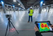
Real-time geospatial tools allow crews to feed updates directly into centralized platforms. One field tech with a tablet can log a soil issue, snap a geotagged image, and have planners respond within minutes, not days.
A contractor in Colorado recently avoided a whole week’s delay when updated topography data revealed a buried drainage line just in time. That’s not magic. That’s smart coordination powered by connected data.
Replacing the Old Guesswork with Smart Certainty
Those days of looking at a map from ten years ago and hoping for the best are behind us. With new, location-specific intelligence, teams can cut out the guesswork.
Unexpected rock beds? You already knew. Regulatory red zones? You avoided them in the design. With the right tech in place, planners can answer the tough questions before the backhoe even starts.
This isn’t just a luxury for big-budget firms. Smaller operations are picking it up, too, because losing three days to a surprise pipeline isn’t “small” at all when every hour counts.
From Planning to Permits: More than Just a Survey
Think of geospatial data as your project’s paper trail — except way more accurate and less likely to be lost in someone’s inbox.
When applying for permits or proving environmental compliance, clear geospatial records make the process easier. Zoning officials want documentation? You’ve got geotagged visuals and time-stamped logs. Environmental concerns? Your site data already shows low-impact zones.
With accurate visuals and trustworthy data, stakeholder meetings no longer feel like interrogations, but more like partnerships. That kind of trust saves time and headaches.
What’s Coming Next? The Road Ahead for Construction Planning
The future’s not slowing down. AI is already analyzing patterns in spatial data to forecast risk zones. Machine learning helps identify things that human planners might miss, such as erosion threats or shifting soil composition.
Soon, predictive planning won’t be a bonus feature. It’ll be expected. And those still working from static PDFs? They’ll be scrambling to catch up.

Final Thoughts: The Tools Are Here. Are You Using Them Yet?
Thoughtful planning starts long before the ground breaks. And geospatial intelligence isn’t a trend. It’s the new foundation.
Whether you’re managing a high-rise or a municipal road, the tools are ready to help you plan with confidence, not crossed fingers. The only question left is: Are you still guessing, or are you building with certainty?


